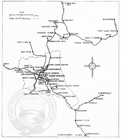
PUDC map c.1948
This map shows the routes served by Pontypridd Urban District Council buses around 1948 and appeared in the official guide to the town.
Notable aspects are the links to Abercynon and Whitchurch which were only works services and the Treforest (via Wood Street) route running to Llantrisant Road. Services not shown are to Penygraigwen and also Oaklands above Cilfynydd, as well as many of the later services around Rhydyfelin which followed development of that area.